Monday, June 10, 2013

Journey to the Northland ; Kerikeri

Salam and hello guys,

It's been a while since I wrote the last entry. But I feel inclined again to write this entry which is part of my travelogue to the Northland region of New Zealand. As I mentioned in the last part of the previous entry, I left Whangarei for Kerikeri in the morning of 21st November 2012.

One of the staff at the backpackers that I was living with was kindly enough to give me ride from there to the bus station, along with two other travelers which I reckon from Germany. We did chat along the ride and I found out that the staff was actually from Levin which is not far from my home at Palmerston North. The German girls also explaining that they are going to Nelson to find summer jobs there.

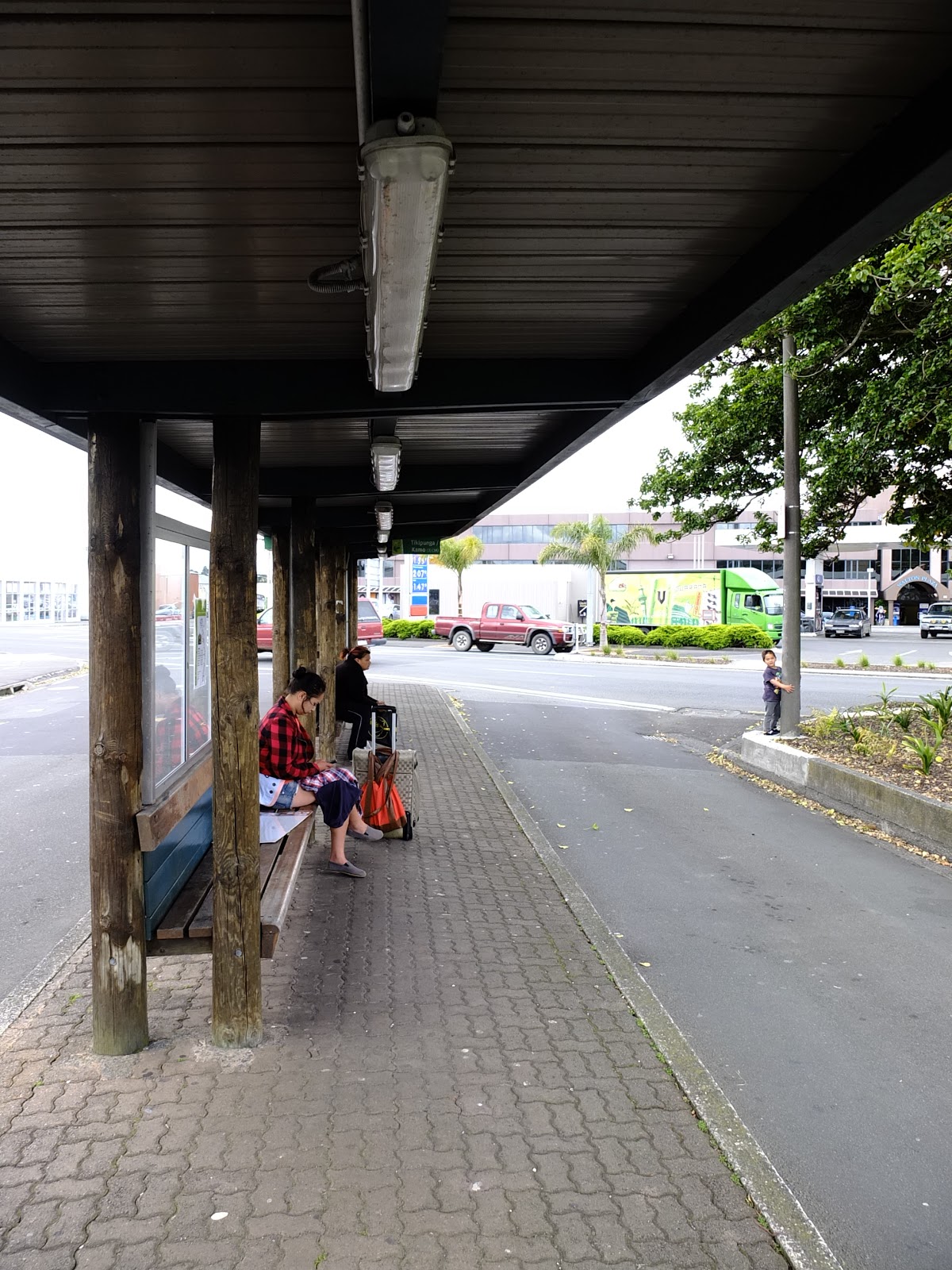
Finally we reached Whangarei bus station after half an hour ride from hotel. It was raining that morning as the same with other days I spent in Whangarei. Coach from Auckland bound for Kaitaia arrived within 15 minutes after that. Most of the passengers are going to Paihia, a tourist attraction town at Bay of Islands which I am going after Kerikeri (will write about Paihia too in the next entry).

People waiting for coach at Whangarei Bus Station


The journey took about one and half hour to reach Kerikeri. As usual, coach stopped at few places such as Kawakawa and Paihia to drop off few passengers. There was also an emergency stop as one of the passenger puked, probably due to the windy road from Whangarei to Paihia.

Finally, I reached Kerikeri. Kerikeri is a small town located almost to the northeastern tip of North Island, New Zealand. It is also called "The Cradle of the Nation" as it was the place where western missionaries made the first encounter with the Maori "Ngapuhi" tribe. They were allowed to build a mission station at Kerikeri Basin, which happened to be the first wooden and stone building at New Zealand. 

I spent five days here and I was staying at KeriCentral Guesthouse and Backpackers. Talking about KeriCentral, most of the guests here are seasonal workers working at the farms, fruits orchard and vineyards around Kerikeri. I was sharing room with five others which three of them are Germans, one from Scotland and another from Italy.Two of the Germans were not working here but visiting Kerikeri and later on going to Coromandel peninsular. Another German guy have been here since two weeks before and working at one of the orchards. The Scottish guy was on his way down from Cape Reinga to Auckland and spent a night here. And lastly the Italian just arrived here and currently looking around for jobs.

My room at KeriCentral.

It was still, raining that day and because of that I have no plan of shooting anything yet. So I went out to the town to buy few things such as canned foods from New World and having lunch. As expected, there were no halal outlet around here, so I had fish and chips instead. For the whole trip here in Kerikeri, I did not cook for dinner since the kitchen was always crowded with people.

Fish and chips with tomato and aioli sauce for lunch.


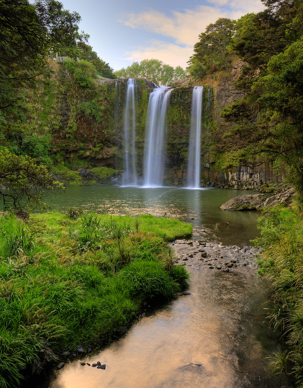
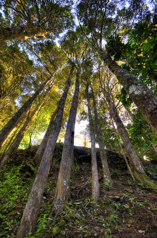
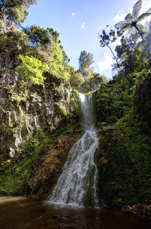
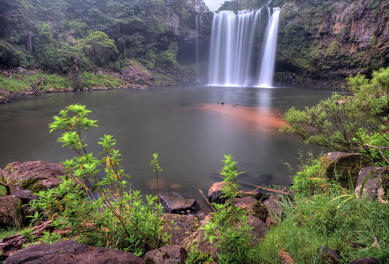
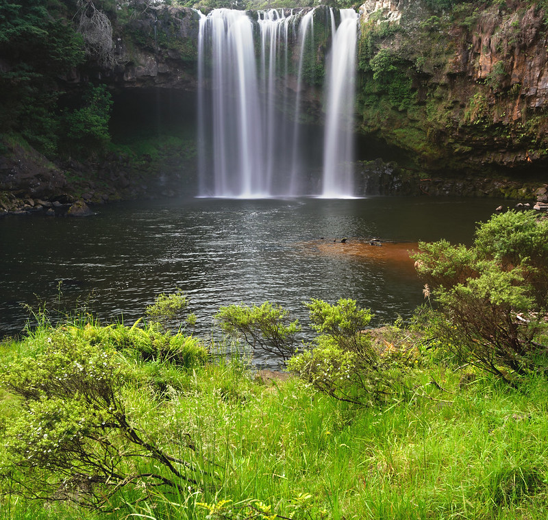
That evening, I went walking to the Rainbow Falls which is situated alongside Kerikeri Basin Reserve. I did not bring my camera since it was still raining and I just want to survey the place for potential angles to shoot. The waterfalls is almost identical with Whangarei Falls which I have visited earlier and it is about 8 meter high. It took me half an hour to walk from town to go there (6 km distance).

Second Day, 22nd November 2012

It was still, raining for the whole day. So I did not go anywhere, except staying on my bed surfing internet (which is free of charge). That evening, I tried my luck walking to the waterfalls wearing my raincoat. It was kinda difficult to take pictures due to the occasional heavy rain and to make worst, the massive water spray from the falls made my camera and lenses soaked with water. This is the only picture I took that day:

Rainbow Falls.


Third Day, 23rd November 2012.

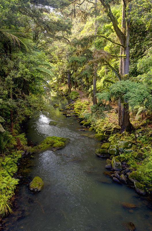
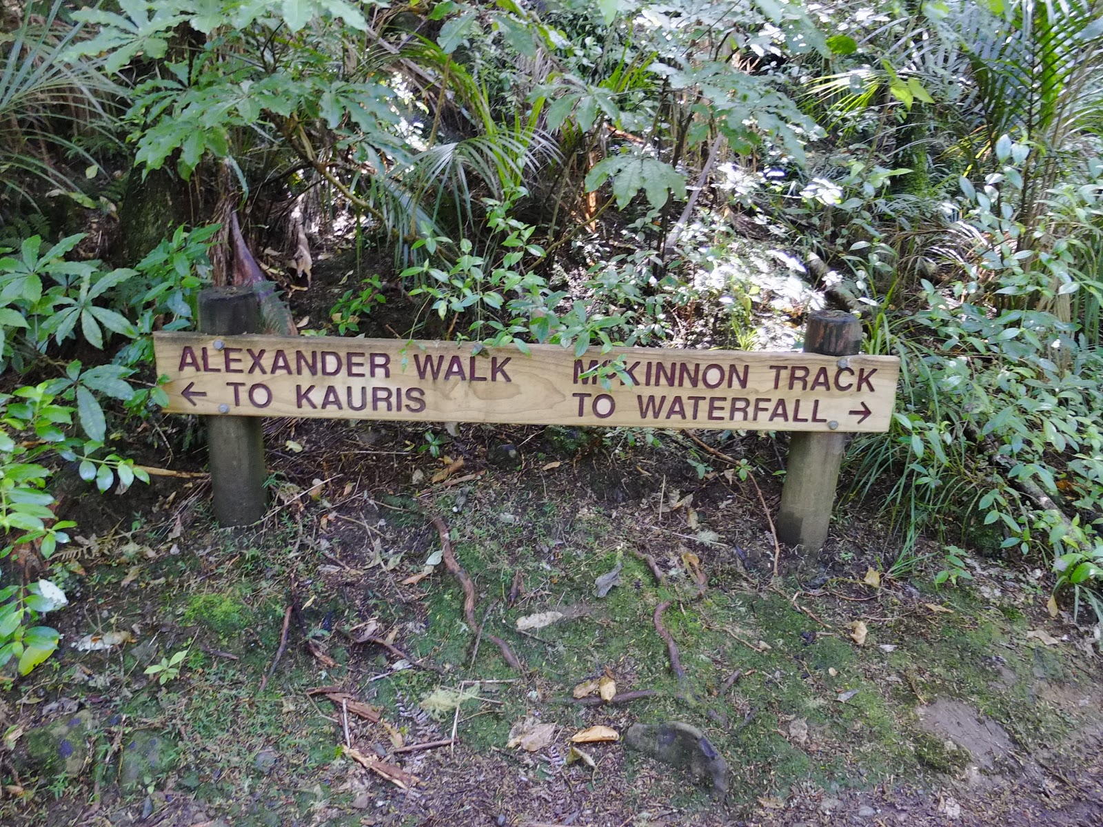
Weather for this day was cloudy which still better than raining like the previous two days. My plan for today was to walk to Rainbow Falls (again), taking pictures there and then follow the Kerikeri Basin Reserve walkway to the end of the trail, which is at the Stone Store and Mission House, which total up of 12 km walk.

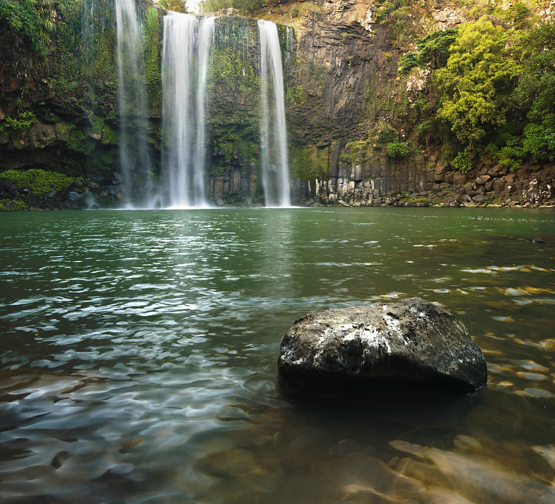
As usual, the water spray from Rainbow Falls made the shooting difficult but this time I brought out my lens cloth to wipe it dry. Below are some of the pictures I took there:

Rainbow Falls, Kerikeri


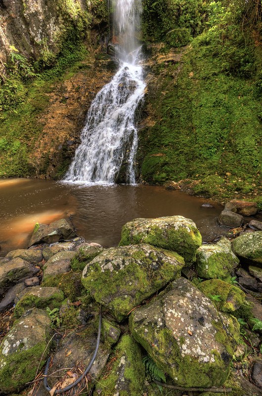
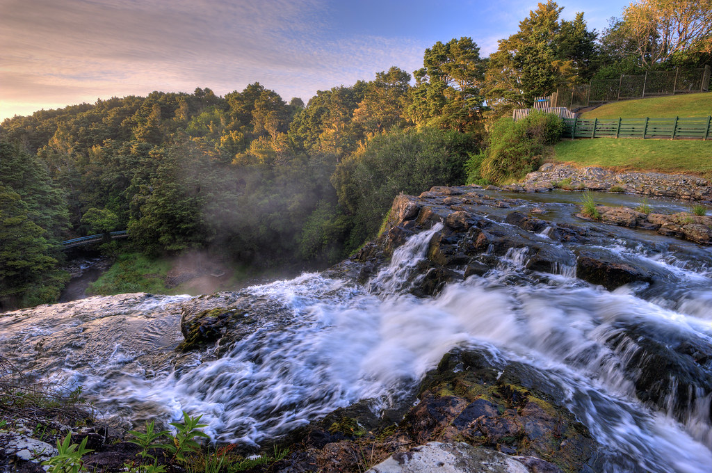
As I walking to the Mission House, I found another impressive waterfalls called Wharepuke Falls. During summer season like this time it is a popular spot for tourists to go swimming. For this shot, I used a circular polarizer and shoot two images for background and foreground at 35mm which later on stitched to form this picture:
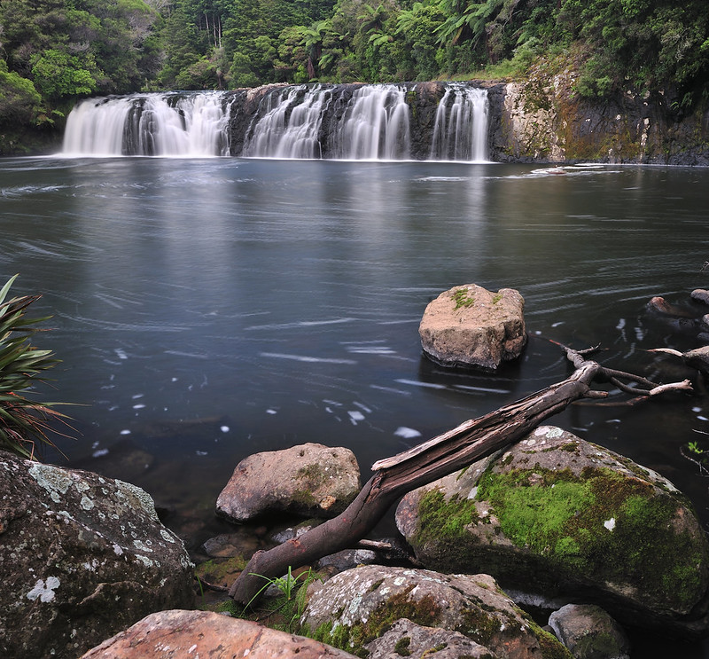

Wharepuke Falls, Kerikeri Basin Reserve
Wharepuke Falls.

Situated not far from Wharepuke Falls, there is remnant of an old hydroelectric plant. It is believed to be the first plant in New Zealand which later on was shut down around 1960s. I dont have pictures of it though.

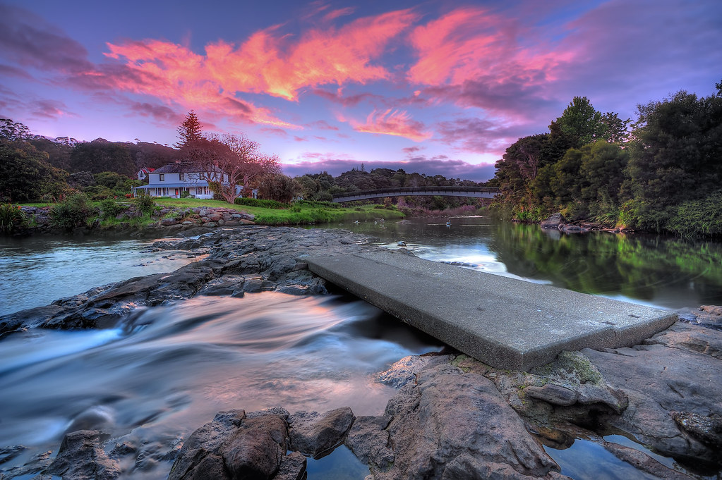
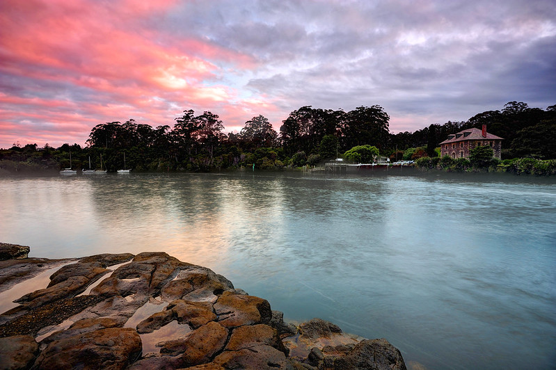
Finally, I reached the end of the walkway, which is the Stone Store. As I mentioned earlier, Stone Store is the oldest stone building in New Zealand. And near to it is the Mission House, which is also the oldest wooden building in New Zealand. It was cloudy that evening but still, the sky got some reddish cast which I later on took some of the photos there.

Stone Store, Kerikeri at dusk
Stone Store.


Mission House, Kerikeri Basin at Dusk
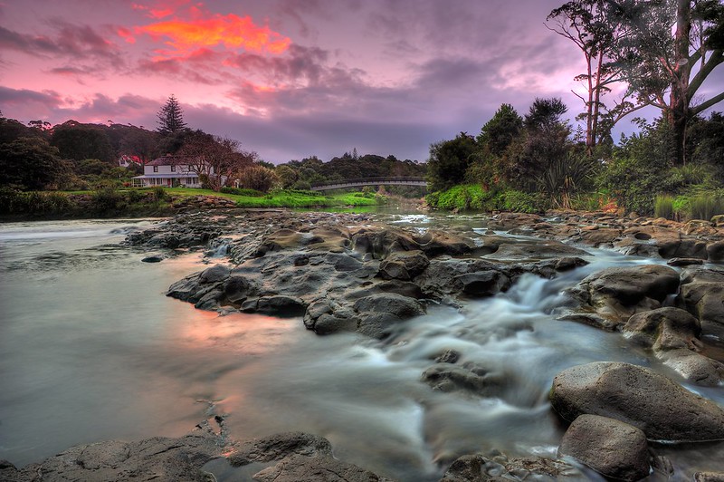
In front of the Mission House, there are rocks which only visible during low tide.


Fourth and fifth day, 24th November 2012

Weather became much better for these two last days in Kerikeri. So I planned to shoot few more pictures around the Basin (and from few different angles). 

Rainbow Falls, Kerikeri
Vertorama from two images. Rainbow Falls.


Rainbow Falls, Kerikeri New Zealand
Sky finally clear, leaving few patchy clouds. This is from five exposures merged in Photomatix.


Mission House, Kerikeri Basin at dusk
View of the Mission House, Kerikeri Basin. Also from five exposures merged in Photomatix.


26th November 2012.

I left early in the morning to catch a bus from Kerikeri to Paihia at 9 am in the morning. I had breakfast at Subway near to the bus stop and shortly after that the bus arrived and I left for Paihia. 

It was not actually in my plan to visit Paihia, but my friend convinced me that there are plenty worth visiting and shooting of so I added this in my itinerary. 

That's all for now. Thanks for reading and stay tune for the next entry of this travelogue ; Paihia, Bay of Islands.


Thursday, January 3, 2013

Journey to Northland, New Zealand - Whangarei

Assalamualaikum and hi everyone,

Not like the previous years where I headed home to Malaysia during summer holidays, this time I spent roughly a month travelling around New Zealand. I was in the Northland region from 15 November to 2nd December and then another trip to central South Island from 9th to 22nd December. In this entry, I would like to share with you my travelogue that I have written before hand during the journey to Northland. I will, in the future writing up on my journey to South Island.

Whangarei (16th - 21st November)

I left Palmerston North on 15th night, taking the overnight Intercity bus to Auckland. It was a pretty long journey with couple of stops along the way to Auckland, be it for toilet / refreshments or drop and pick up passengers. After 10 hours of the journey, finally I reached Auckland safely at morning of 16th.

Intercity Overnight Service from Wellington to Auckland.

From Auckland terminus, I took another bus to Whangarei. It took about two and half hours to reach Whangarei from Auckland. As I was pretty tired, I slept during most of the journey, but sometimes I did wake up and look around. The bus route did pass through some beautiful places such as Wellsford, Waiwera, Shakespeare and many more. Northland region is diverse in terms of the vegetation (thick rainforest), beaches, rivers and waterfalls, and I just seen less than quarter of these during this journey.

Finally, I reached Whangarei safely. I was initially requesting pickup from the accommodation staff but somehow they did not respond so I have decided to take city bus from town to the hotel. In Whangarei, I was staying at the Whangarei Falls Holiday Park which is located at suburb of Tikipunga which is about 5 km from town. It costs me $3 for bus fare to go there.

Waiting for bus at Rose St Bus Terminal Whangarei.
While waiting for bus, I was approached by this Maori guy. Friendly fella, I supposed. We chat while waiting for the bus since he is going the same way I am going. I told him I'm from Malaysia and he seemed surprised because he was also been to Malaysia for mission work. Bus arrived and I went aboard. Finally after a while I reached hotel safely. 

At the hotel, I was greeted by the owner, Mrs Alison. She was nice and friendly. She explained to me on the stay and showed me around the place. It was a nice place though, although pretty far from town. The closest supermarket was Countdown Tikipunga which is about 2km walk. 

Panoramic picture of my room. Got the whole cabin for myself.

View from outside of my room. There is a swimming pool and behind were shower block and kitchen.

I stayed here for six days and the main intention was to shoot the picture of nationwide famous Whangarei Falls. The reason why I spend a long time there was to accommodate for the right weather and lighting in order to get great images. I was right. It was raining heavily for three out of six days and I spent those days in my cabin, sleeping hehe  :D

Just a side note here. To save up costs, I did cooking for breakfast, lunch and dinner at the kitchen provided there. I brought with me my own pan and rice pot due to the hygiene reason (Halal matter) and I bought most of the cooking stuff from Countdown. 

Since it is summer currently and the daytime is much longer than night, I went out to the falls once I finished settle up stuff in my cabin. I was lucky because I was able to shoot few nice images that evening from the falls. 

Whangarei Falls
Whangarei Falls.


Whangarei Falls
View from closer angle.


On the second day, I was initially planning to shoot sunrise from Town Basin. So I did get up early at 3 am and walk from my cabin to town for 5km. Instead of sunrise, it was cloudy that morning so I decided to do long exposure instead.

Town Basin, Whangarei
Town Basin Marina, Whangarei.

It was raining heavily that afternoon so I did not go anywhere to shoot pictures. 

Weather became much better on the third day. Since my initial plan to shoot the Whangarei Falls was successful, I spent the rest of the time around the nearest forest reserve. So that day, I went walking for total of seven kilometer through A H Reed Memorial Forest Park and also Mair Park. 

A H Reed Memorial Park and Mair Park are parts of the Hatea Walkway which stretch from Whangarei Falls to the Town Basin Marina. There is also side track which go to the Parihaka Hill Scenic Lookout which I didn't have chance to go with. So I started walking around 8 am from my cabin to Whangarei Falls, where this walking track begin. 

AH Reed Memorial Park Whangarei
Somewhere near to the falls.


Hatea River
View of the river from bridge. Can be seen on the right side is the track.


It is 35 minutes walking from the falls to the Memorial Park. 

Whangarei Falls, seen from the beginning of the walking track.

The track continues to go alongside with the river. There are two pools that I reckon being generally used as a swimming spot. Then the track go across the river via a swing bridge. I seldom go across a swing bridge so I feel a little bit creepy though, especially when the bridge swing to the left and right.

Swing bridge.


The track passes over this meadow where I came back later on the day to shoot sunset.


Finally, I reached A H Reed Memorial Park after half an hour walking. There are two attractions here; first is the Kauri Canopy Walk and secondly the Paranui Falls. The canopy walk is a loop track that surrounding a group of big Kauri trees. Logs from Kauri are being used to make big ships, war canoes and houses by the Maori people.

Walking track just before I reached the beginning of Kauri Canopy Walk.


I think it is about 5 to 8 meter elevated from the ground.

Info board about Kauri trees.


Then, I went to the Paranui Falls. This waterfalls is not so famous compared to Whangarei Falls and I know why. There are no proper walking track to the base of waterfalls and just being indicated by arrows only. The other reason was that it is too slippery to walk to the base as there are heaps of moss on the rocks and stone near to the stream. Alhamdulillah I made it safely to go and back. 

 Track to the waterfalls.


Stream that coming from the waterfalls.

Paranui Falls
Base of the Paranui Falls.


Paranui Falls
View of the top.


Finally I have done the A H Reed walk. From the exit gate of the park, there was 700 meter walking by the side of the road which was indicated by arrow which is going to the Parihaka Scenic Reserve (which including Mair Park). Since it was Sunday, there are many people there doing walking and also having picnic alongside the track and by the river.

Mair Park Walkway.


View from the Mair Bridge.

Finally I came to the end of the walk which converged with the main road to city. I walked back using that road back to Tikipunga and then back to cabin. Got few hours of rest, also to cook for dinner before (as I mentioned earlier) I went back to the meadow area to shoot the sunset.

A H Reed Memorial Park
Heaps of clouds that time.


Fourth day which was on Monday. I woke up early that morning to shoot pictures. This time I have no need to go further as I went to the top of the Whangarei Falls which is just about 2 minutes walk from cabin. The weather turned out great and I found good spot and angle to shoot. Not only good, but safe as well as I did not want fall down 8 meter below. 

Whangarei Falls at morning

That was the last time of the day that weather turned out good before it started to become gloomy that evening. So I called it a day off. 

The fifth and last day. I planned to do coastal shooting at Onerahi, the suburb area 12km from Whangarei City. Prior to the trip, I made research on the location and there is beach area there with a pier. But as soon as I get there, I found that it was not so suitable for shooting from my judgement of composition etc, plus weather that day was gloomy. So without taking any pictures, I went back home. It was just at the lookout near to the airport that I took couple of shots of the Whangarei Heads.

Can be seen at the background ; the mighty Mt Manaia on the left.


On the morning of 21st November, I left Whangarei for the next destination; Kerikeri with coach. 

It was a nice visit to Whangarei. There are many other interesting places here to go but due to the limit of mobility (I cannot drive) and weather conditions so I could not make it. Next time perhaps. 

Stay tune for my next entry ; Travelogue recorded at Kerikeri.


Tuesday, January 1, 2013

2012 ; Year In Pictures

Hi guys,

This entry is basically featuring pictures of some significant events that I captured throughout the year, from January to December 2012.

May the new year 2013 being filled with opportunity and a time for peace, hope and unity.

#1
DSC_9016
2 January 2012 - Outing with Lensa Malaya at Broga, Semenyih - Was organised by Lensa Malaya as the first activity of the community for 2012. 


#2
DSC_9695
7 January 2012 - First AGM of OASiS (Old Boys of ASiS) - ASiS Principal, Encik Baharuddin Burhan gave his speech.


#3
DSC_9895
7 January 2012 - First AGM of OASiS (Old Boys of ASiS) - The attendees of the meeting.


#4
The Long Journey.
25 January 2012 - Solo Trip to Penang - The iconic Penang Ferry. I pretty enjoy travelling alone.


#5
Morning at the foothill of Bukit Larut.
1 February 2012 - Went to Maxwell Hill for the first time - Although it is not far from my home, this is the first time I went there.


#6
Outing LensaMalaya KLCC 7hb Februari 2012
8 February 2012 - Outing with Lensa Malaya - KLCC. It was organised by myself under LensaMalaya banner.


#7
DSC_2397
11 February 2012 - Lensa Malaya Central Family Day. Was held at Bagan Lalang, Sepang.


#8
Le Waiting (Part 2)
22 February 2012 - Back to New Zealand. One more year to go.


#9
DSC_4277
24 March 2012 - Festival of Cultures 2012. Annual event held at The Square, Palmerston North.


#10
Vertorama | Milky Way over Manawatu River
Milky Way seen over the sky of Palmerston North, 28 March 2012.


#11
DSC_5350
31 March 2012 - 75th Anniversary of Royal NZ Air Force. Almost similar, but not that grand compared to Malaysian's LIMA.


#12
Le Waiting Part 3
9th April 2012 - Easter Break trip to Wellington. Went there for a week, thanks to Fuad Afif and Dr Rosli for hospitality.


#13
DSC_6249
14 April 2012 - Easter Break Trip to Wellington. Was planning to go to Castlepoint, but somehow could not proceed so we went to Wainuiomata Coast instead.


#14
Ice Skating
25 June 2012 - Ice Skating - The Square, Palmerston North. 


#15
DSC_8118
28 June 2012 - Salam Perantauan Photoshooting.


#16
Bersatu Games 2012 - 3rd July
3rd July 2012 - BERSATU Games 2012, Christchurch. MUMSA managed to went back with a bronze medal, this time in pool game.


#17
Bersatu Games 2012 - 4th July
4th July 2012 - BERSATU Games 2012, Christchurch. Team Canter, the host of this year event won the overall games, including this volleyball.


#18
Bersatu Games 2012
5th July 2012 - BERSATU Games 2012, Christchurch. Contingent from Wellington, WMSO.


#19
DSC_0322
7th July 2012 - Solo Trip to West Coast region. I was there for a week. Love it there and want to come again, if given chance.


#20
DSC_0578
10th July 2012 - Solo Cycling Trip. My first long distance cycling. I finished 170km within three days around West Coast.


#21
Solat Eid-ul-Fitr.
19th August 2012 - Eidul Fitr Celebration. The fourth time I celebrated it here in Palmerston North.


#22
Rifqi.
19th August 2012 - Eid Fitr Celebration. 


#23
_DSC1768
19th August 2012 - Eid Fitr Celebration. Malaysian Community of Palmerston North, New Zealand.


#24
Solat Time.
11 October 2012 - Solat Time. Common view at Islamic Centre, Massey University.


#25
Wellington Station
21 October 2012 - A day visit to Wellington. I went there one week before final exam, just to relax myself around the city.


#26
Whangarei Falls
16 November 2012 - Summer Trip to Northland region. Went to the Northland region for the first time. First destination was Whangarei. Nice place with nice people.


#27
Mission House, Kerikeri Basin at dusk
24th November 2012 - Summer Trip to Northland region. After Whangarei, I went to Kerikeri. The cradle of the nation we call it.


#28
Paihia
26th November 2012 - Summer Trip to Northland Region. Spent the last four days at Paihia, Bay of Islands. Nice beaches and seaside.


#29
_DSC4494
30th November 2012 - Summer Trip to Northland Region. I was lucky to get decent discounted price for this luxury overnight cruise with Great Sights.


#30
Queenstown at dusk
9th December 2012 - Summer Trip to South Island. I went back home after trip to Northland and a week after, I went out again. This time I went south and it begins in Queenstown.


#31
En route to Glenorchy from Queenstown
12 December 2012 - Summer Trip to South Island. I love being in the countryside, where there are not many people around. This is Lake Wakatipu, en route to Glenorchy.


#32
Routeburn
14 December 2012 - Summer trip to South Island. When I was in Glenorchy, I spent a day doing overnight hiking to the first part of world famous Routeburn Track. Although I have to cancel my plan to do further walking up to the mountains due to the severe weather, I pretty enjoyed walking around here especially at Routeburn Flats.


#33
Tekapo.
18th December 2012 - Summer Trip to South Island. The last destination for this trip was Lake Tekapo. Nice place with nice scenery. Every season got its own charm and for summer, there are lupines growing around the shore of the lake.


That's all for 2012. Insya Allah, there will be more stories to be told in 2013.

Cheers.