It's been a while (pretty long time) since my last blog entry. I'm pretty much busy lately and that hindered me from blogging. But I managed to steal some of my time to write back whatever I have left discontinued before, which is my travelogue around New Zealand during my final year in 2012.
The bad things of leaving this travelogue for a long time are that I probably has forget some of the moments that I have remembered during this journey, so I have to look back upon the pictures that I captured and put in an order so that I could write anything related.
So here we go,
Going Southwards ( 26 November 2012)
At Kerikeri, I checked out from my hostel early in the morning as I have booked my bus ticket at 10.00 am. Bus stop was not far from hostel and within walking distance. While waiting for the bus to turn up, I had my breakfast at Subway which is just in front of the bus stop. Finally bus has arrived and it's bound for Auckland.
The journey to Paihia did not take much time since it is not really far from Kerikeri. After about 45 minutes from Kerikeri, finally I reached Paihia. Bus stopped at the I-Site, which is located at the center of the town. From there I walked to my hostel, YHA Bay of Islands situated at the southern part of the town and not really far from the beach.
The hostel is very spacious. The ground floor consists of receptionist, kitchen and dining room and also TV room while first floor is where the rooms are. I booked myself a 4-person room and sharing it with the others. There is person in-charge of cleaning the room and other communal rooms from 10 am to 12 pm.
 |
| View from outside of my room. |

The coast is clear. Not many people here during this time since they went out to travel around.

Ground floor. The sliding door is the entrance into the kitchen and dining room.

Dining room.

Kitchen. I used to cook during off peak hour so no need to queue up to use the stove.


The front view of the hostel.
So after finished loading up my stuff at my room, I went out to walk around the town. I planned also to get across the bay to Russells by ferry to shoot sunset from there.
Paihia, Bay of Islands (26 November 2012)
Paihia is a town located in Bay of Islands region in northern part of North Island, New Zealand. Being surrounded by beaches, islands and coves, it is famous as tourist attraction. During this travel, there were many tourists and travelers here coming from around the world for holidays. I walked from hostel to town dropped by the beach just 100 meter from hostel to snap few pictures.

Secluded, shady part of the beach near to the town's jetty.

Beach near to my hostel in Paihia.


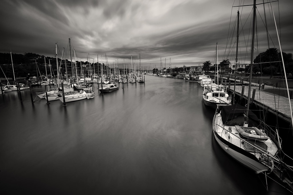
Many yachts and boats moored here.
Romantic Russell.
As I mentioned earlier, I planned to go to Russell via ferry from Paihia. So I did. Since it was in the middle of summer that time, the sun set quite late, which was around 8pm. So I have plenty of time to walk around the township of Russell that afternoon. The ferry services to Russell from Paihia is located at the jetty behind the I-Site, running until 10.00pm for the last ferry from Russell back to Paihia. I forgot how much does it cost, but you can pay it to the ferry driver for every single journey.

View from the center of Paihia Town.

Jetty to Russell.

Finally, ferry arrived. The journey took around 15 minutes before reaching Russell.

View from inside the ferry.

Tourist family that join together on board to Russell that afternoon.
Finally I reached Russell. The weather is still, great at that time and fiery sunset seemed promising for my camera :) But it was quite early so I decided to walk around the town and then walk through the jungle track to the Flagstaff Hill Reserve located on the hill nearby that overlook the town and bay.
Russell, formerly known as Kororāreka, was the first permanent European settlement and sea port in New Zealand. It was once an important city and port in New Zealand. It has a bad reputation once as the "Hellhole of the Pacific" where bandits, pirates and outlaws are settling here. After the Treaty of Waitangi and the administration moved to modern day Auckland, the town are pretty much abandoned and only nowadays has small amount of population residing there.
It is also known as "Romantic Russell" simply by its beauty and usually couples choose to spend their honeymoon here, having dinner while enjoying the view of the beach during sunset.

Russell main jetty.

Russell also got beautiful beach, stretching all the way to the northern side of the town.

Russell Town Hall.

Beautiful beach side and this road.

The signboard showing the direction around the town.

Secluded area with a bench. I imagined this area will looks beautiful during sunset and late evening.

Unused boat overturned.
After finished and satisfied walking around the town, I went up to the Flagstaff Hill by Flagstaff Hill Track.
The journey went uphill across the forest reserve. I did stop many times to rest since I carried my camera and tripod together and since the journey is going uphill. But there were many fantastic stops around where I can bring out my camera and taking few good photos.

I stopped at this viewpoint since I was tired. And it turned out that it's pretty good place to take photos :)

Came across this weka bird. It almost resembled the rare kiwi birds which are not easily found these days.
Finally, I reached the peak of Flagstaff Hill. Before this hill was used for the flagpole it was occupied by prehistoric Māori, which is seen by the terraced slopes of the hill.During the period from 1840 to 1913 six flagstaffs were erected here. The flagstaff previously erected at Waitangi was transported across in March 1840. The flag of the confederation of Maori tribes was chosen by the Maori people in 1834 and had flown until 1840. Some Maori in the Bay believed that the Union Jack was a symbol of their loss of authority and prosperity and they believed terms of the Treaty were not being honoured. The first four flagstaff’s were cut down by Hone Heke and his cohorts as an objection to British sovereignty sparking the Northland wars. The flagstaff was never erected again during the lifetime of Heke.

Stairway to the peak of Flagstaff Hill.

The written history of Flagstaff Hill.

Beautiful view up here.

View of the township of Russell.
After spent time up here, I walked downhill back to the town as the sun was going down.

Beautiful view of Russell.

Beach at Russell just before sundown.

Setting up my stuff to capture the sunset near the jetty.

Result from my camera that evening.

There you go....the beauty of Russell during sunset. Sun setting down at Bay of Islands.

View at the jetty just after sun setting down.
The Treaty Ground - Waitangi (27 November 2014)
My plan for the second day was to visit Waitangi which is situated not far from the town, on the way back to Kerikeri and Kaitaia. That's the plan for that afternoon so what I did in the morning was to cook my breakfast, editing pictures, going online and also cook for lunch. Lucky that day, I met a family from Malaysia who happened to stay at the same hostel and were on their holidays that time. So we chatted a lot while having lunch, especially on the holidays plan.
After finished lunch, I packed up my stuff and started walking slowly to Waitangi. It took me around 45 minutes walking slowly along the beaches near Paihia, enjoying the view. Finally, I reached Waitangi and went straight to the entrance of Waitangi Museum.
By the time I arrived, the area was to be closed already and the receptionist there suggested me to come back tomorrow. But then I decided to continue anyway since it was going to rain tomorrow according to the weather forecast. The entrance fee is $25 for adult and $5 for child.
The area is large, consisting a museum building that display the historic timeline of the Treaty of Waitangi, the rebuilt site of James Busby's house (James Busby is the British Resident before the Treaty was signed), Waitangi Ground and Te Marae (Maori house).
For those who want to know about the Treaty of Waitangi, basically it is a treaty signed between British Government with the local chiefs from various tribes (iwis) that consists of mutual agreement that the local Maori tribes recognized the governorship (kawanatanga) of the British government upon New Zealand (Aotearoa) and in return British will recognize the chieftainship (rangatiratanga) of the local tribe leaders. For Malaysian, it is almost the same with Malayan Union, except that our Sultans did not signing the agreement thus not recognizing it.

View inside the museum.

Wheelchair and the signboard near the Treaty Ground where the flagstaff located.

Replica of the dining room inside James Busby's house.

Displays inside James Busby's House.

Courtyard of James Busby's house.

Te Marae, or the meeting house in Maori. It was built near to the Resident House and the suggestion to build it was proposed by Sir Apirana Ngata, the first Maori politician and member of New Zealand Parliament.
When I arrived at Te Marae, there was a meeting being conducted inside so I decided to wait. During that time, I was approached by a Maori-descent security guard who was also waiting for the meeting to finish. We chatted a lot, especially about the history of the Maori and Polynesian people that finally residing in New Zealand thousand years ago. I did tell him that the Malay people are somehow inter-related to the Polynesian people and I gave him few examples in terms of Malay words that relatively similar in Maori language such as:
1. Dua - Rua in Maori which means two.
2. Lima - Rima in Maori which means lima.
3. Telinga - Taringa in Maori which means telinga.
4. Benua - Whenua in Maori which means continent.
5. Mati - Mate in Maori which means dead.
He seemed impressed. We continue to talk and finally the meeting was finished so I was be able to go inside the Marae to take pictures.

View inside the Marae. Beautiful carvings I must say.

Bench in front of the carved pillars - Red Indian called it totem pole.

The Flagstaff outside the Marae and in front of the James Busby's house. This is where the meeting between British Government representative, Sir William Hobson (who later on become the first Governor General of New Zealand) and the local iwi chiefs from Nga Puhi tribes. This is also where the signing of the Treaty was taking place.

Replicas of the Maori huts nearby the exit way.

Two giant Waka, which is big Maori boat being displayed here at The Treaty Ground. At the end of these boats, there is the bark of the giant Kauri tree which was used to construct these wakas.
After finished and satisfied going around the place, so it is time to go back to Paihia, and then to my room. But as it was almost late evening, I took the chance to capture sunset images so I went scout around for the best vantage point which I found it just in time. There is a pier near to the outlet of Waitangi river which has many boats and yachts moored there. By the time I reached the pier, there were two guys fishing there. Judging from their looks, they are Chinese. But when I asked, they came from Samoa and having holidays there.
Time has come for me to take pictures and these are two of my best shot there:


Done taking pictures, now I walked back slowly to my hostel. I didn't cook for dinner and having instant noodles instead since I was tired to do so. I slept early that night, as usual.
That concludes the first part of the Paihia series. In the next entry, I'll write about my experience on having overnight cruise around the islands of Bay Of Islands.
Thanks for reading :)