During last winter break, I had a chance to travel alone to West Coast. West Coast is a common name for Westland region located in the western part of South Island which is from Buller in the north to the Franz Josef in the south. But I did not go to all of this part, just spending my time at the Grey District only which is around Greymouth, Coast Road and Lake Brunner. I was actually planning this trip from early of the year and Alhamdulillah, it went as planned.
Friday 6th July 2012
I took a shuttle from Christchurch to go to Greymouth. Actually I was in Christchurch a week earlier to attend the annual BERSATU Games that ended on Thursday 5th July. Shuttle departed at 7.30am and the journey took about four hours before reaching Greymouth. The sceneries alongside roads towards Greymouh were so fantastic, especially when we were reaching the Southern Alps Range but unfortunately we did not stop much so I couldn't take any pictures except from inside the shuttle and during short break at Arthur's Pass.
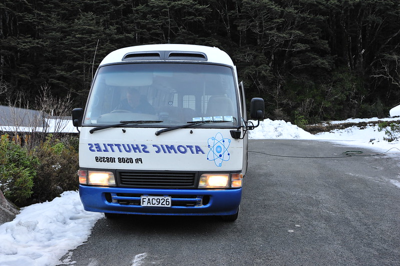
Atomic Shuttle that I took to get to Greymouth.
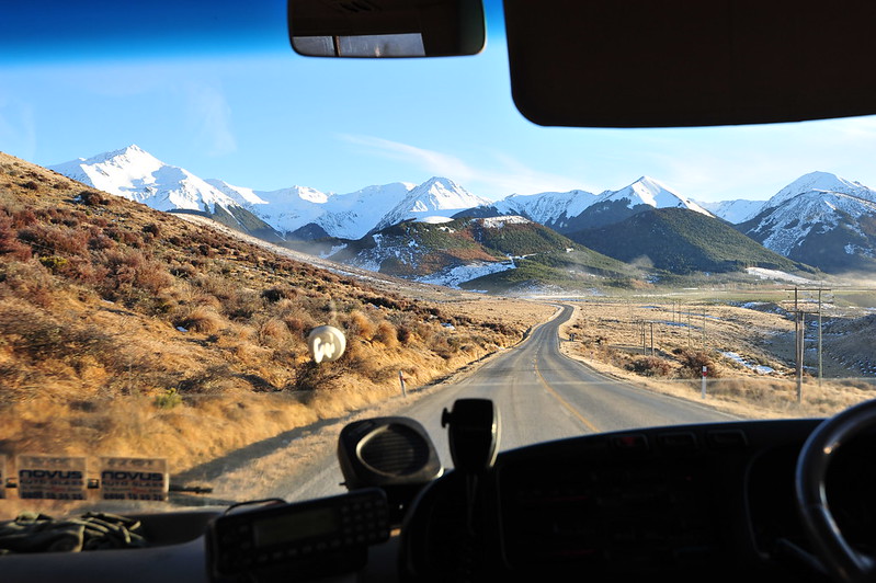
Southern Alps from inside shuttle.
As I said just now, the shuttle took a short break at Arthur's Pass. Arthur's Pass is a small township that located in the middle of this Southern Alps Range. During winter season like this, many people travel here especially those who are doing snowboarding and skiing at the winter fields nearby. According to the driver, for the last three days, there was a winter blast that made this area and its surroundings were piled up with thick snow.
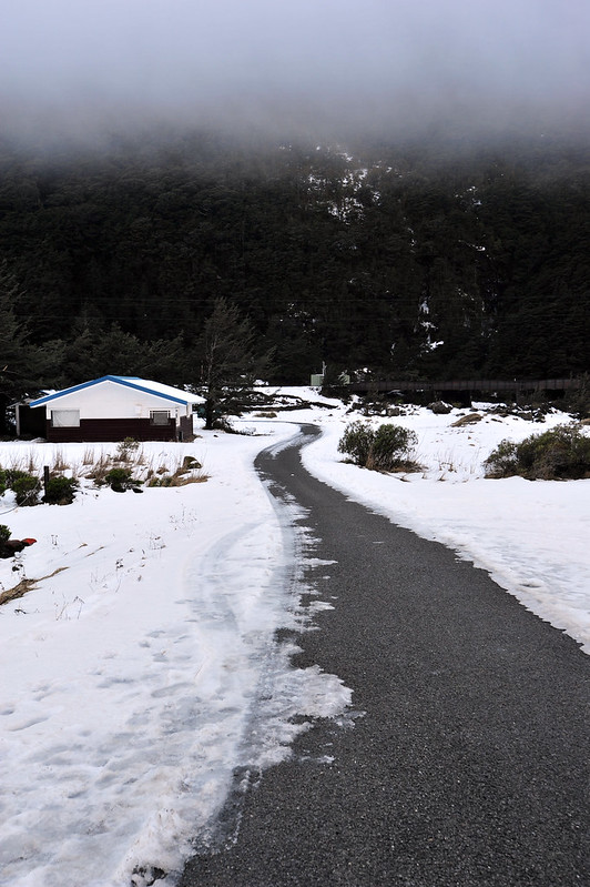
Around Arthur's Pass.
Road across this town. Every morning, there is a truck that clearing the road from ice and frost.
Finally I reached Greymouth around 11.30am. From here, I took a cab to Rapahoe that is located around 10km northwards of Greymouth. For the whole trip, I was staying here at Rapahoe Beach Motor Camp. It is a camping area beside the Rapahoe Beach, and also has few cabins. The price was quite good, which is about NZD25 a day. There was no phone coverage but a good things was there is WIFI so I can access internet from here.
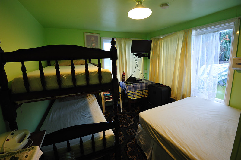
View inside the cabin that I was staying for a week.
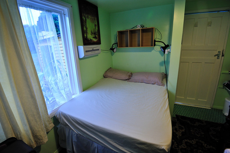
Bed was spacious, but it was so freezing cold at night even with the heater on.
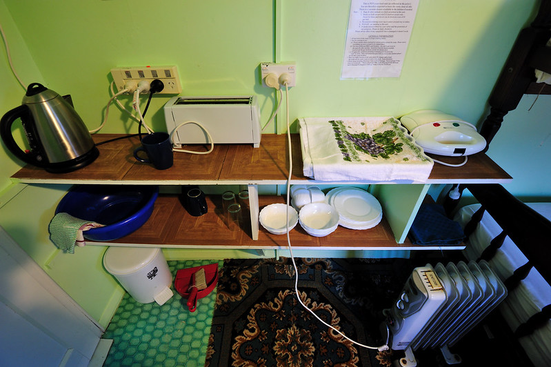
"Cooking" appliances. There was a kitchen at the main hall outside.
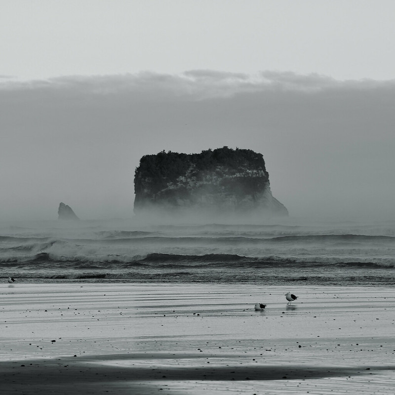
Motukikie Rocks
Although just arrived, I decided to go to Motukikie Rocks that afternoon. This was because usually the weather at the coastal area is quite unpredictable. Moreover, that day was the best day to go according to the tide schedule where it will be low tide during sunset. For your information, this area cannot be accessed except during low tide only.
Talking about Motukikie Rocks, it is located about 7km north of Rapahoe. Because I'm walking, I moved out early from cabin. The journey took about one hour and half by the Coast Road.
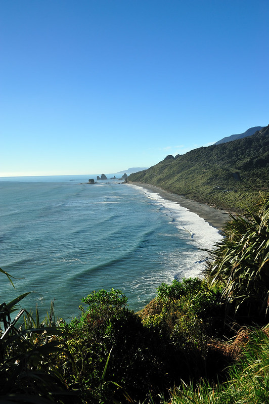
View of Motukikie Rocks from Ten Miles Creek viewing point.
Finally, I managed to reach Twelve Miles Bluff where the Motukikie Rocks is located. In order to go down to the beach, I need to walk through a narrow and steep track in the bushes, and using ropes and a steel ladder down of the cliff before reaching the shore (this track is not really known to the public, and I was told by the locals here, few weeks before this trip).
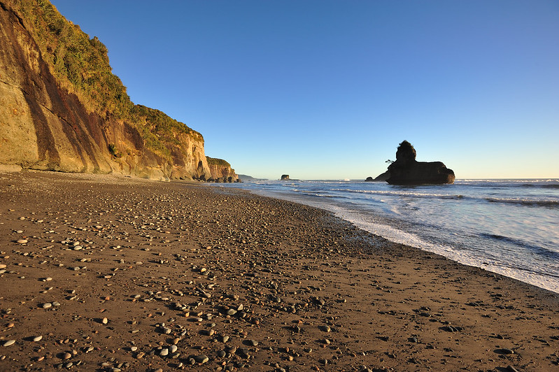
Beach at Twelve Miles Bluff.
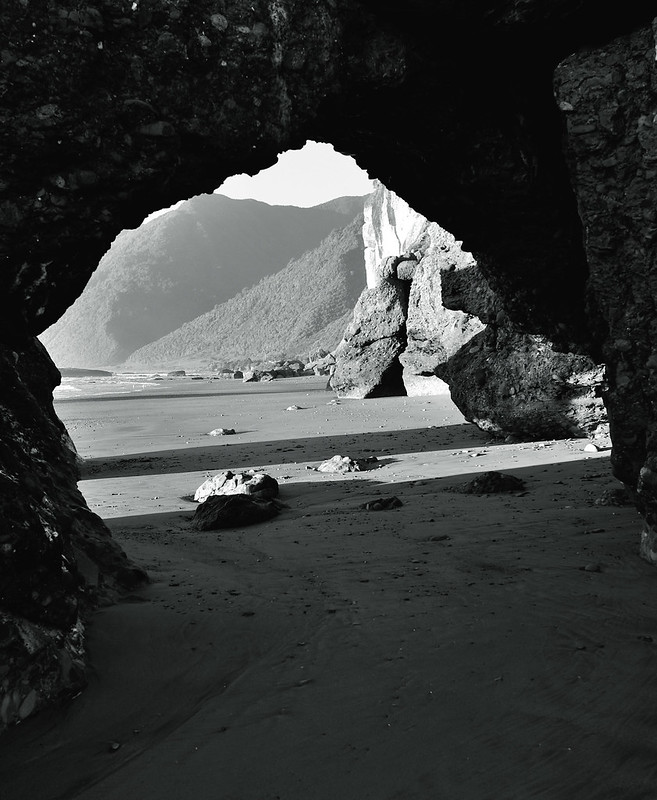
Corrosion caused by the tides and extreme weather here had actually crafting the rocks into unique, distinctive shapes of archway.
A unique rock structure.
Although the water are going off, but still there were waves that coming off, sometimes in a monstrous scale. It was hard to predict whether it is safe or not being here. The sea looks pretty calm at a time ; and a minute later became dangerous. I myself got wet up to the waist level as I tried move from one part of the beach to another.
Another things that was quite scary that when I was there, I kept listening to the sound of stones that fall off the cliff. It was like the cliff could collapse anytime without warning. Just few weeks prior to this trip, I was told by the locals here that there was huge rockfalls at the southern side of the beach. So, I keep myself within proper range to the cliff for safety reason.
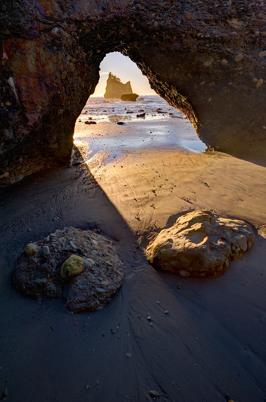
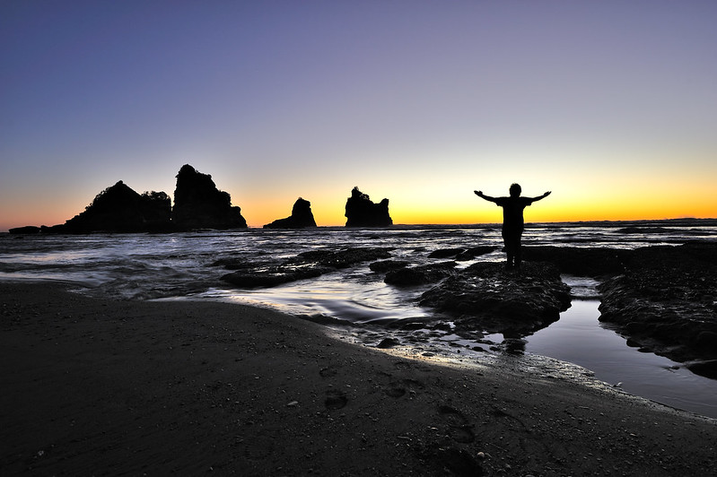
Sun was about to setting down. After looking around for a good angle, so I set up my tripod and camera to take pictures.
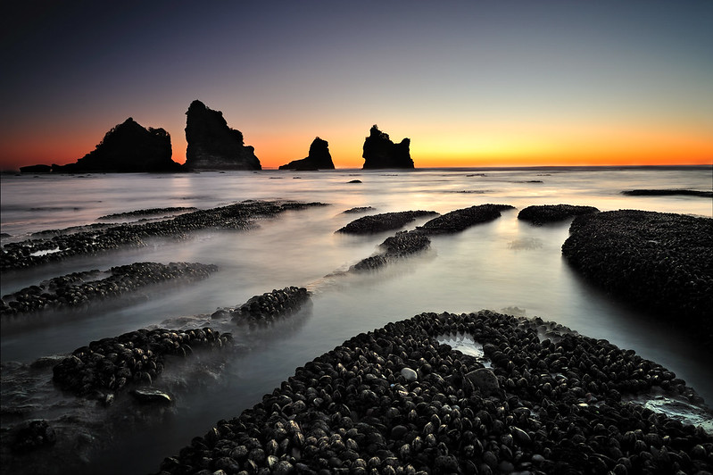
The picture above shown Motukikie Rocks as the subject during sunset. You can see at the foreground, there is a group of mussels where I was actually stepping on it to take this picture. I used two filters for this shot, which is GND0.6 and ND1.2.
Feel satisfied when I managed to reach this area.
Since it was getting dark, so I packed up my stuff to return back to my cabin. Instead of the track that I walked through before, I eventually walk alongside the beach to the north where there are a small settlement which has access from beach back to the road.
I was just realized that during the time I was at the beach, there were no one there but me.
I need to walk back to the cabin so there was another 7km to be finished that night. Because I was exhausted, so I decided to have a short break at few places that have bench and chairs (viewing points alongside the road). Since there were no road lights, I brought a torchlight. It was clear, cloudless night that there were a lot of stars on the sky. So, I decided to take few good shots there.
Below are few first pictures of Milky Way that I took using my Nikkor 16-35mm f/4G lens. Because its maximum aperture is not that big, so I had to expose my camera sensor more than supposed to be.
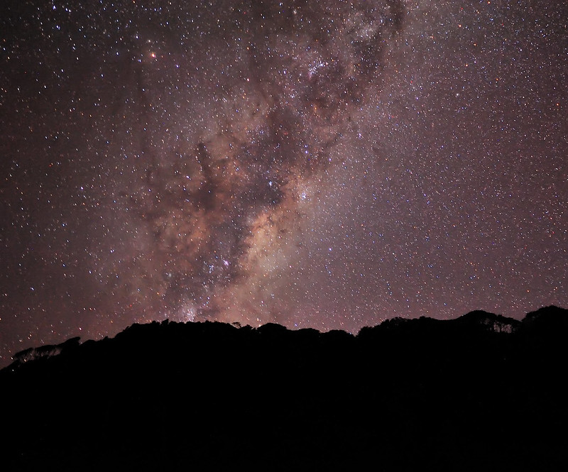
Southern Paparoa Range at night.
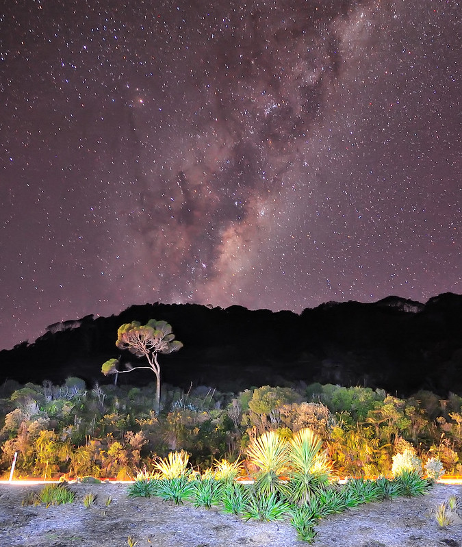
As you could see, there are some "trailing effect" of the stars in the pictures above.This was due to the long exposure that I made. Also, the picture a little bit soft due to the noise reduction that done during post processing.
Alhamdulillah, after about two and half hour I managed to reach cabin safely. Due to the freezing cold temperature that night (-1 to 2 degree Celcius), it was difficult for me to sleep so I decided to make editing and upload some of the pictures in my facebook.
Saturday 7th July 2012
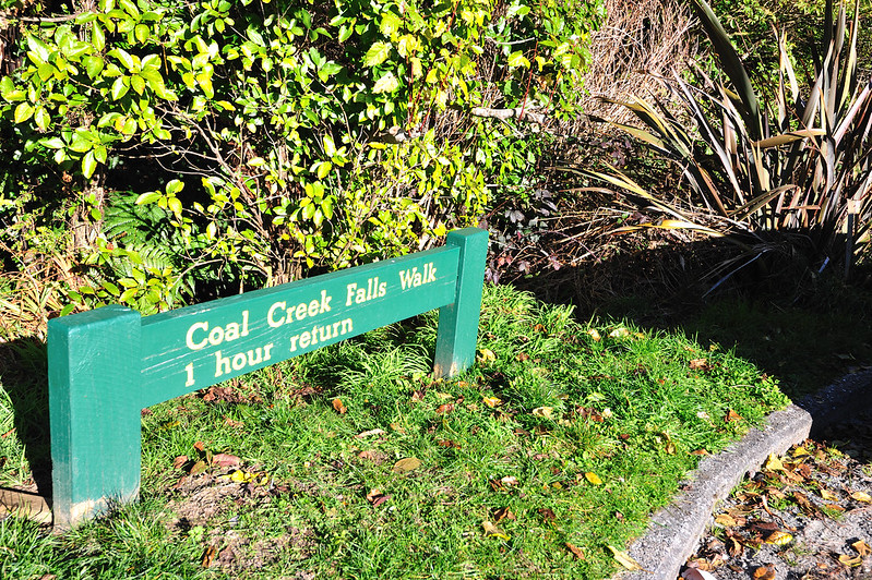
The plan this morning was to go to Coal Creek Falls. Due to the tiredness from the previous day, I left my cabin quite late, which was around 11am. Coal Creek Falls is located about 4km from Rapahoe, which the closest town is Runanga. Runanga initially was a settlement for the workers in gold mines, and now it is inhabited by the workers of the coal mines nearby.
In order to go to the waterfalls, I need to walk alongside 1km track into the jungle. It was not that hard since the track was flat and quite broad to walk.
Alhamdulillah, the timing was right when I reached the waterfalls since there were sunlight directly to the falls, made the red colour on the rocks real vibrant. For the pictures below, I used a CPL and ND1.2 filters.
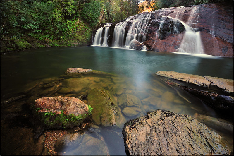
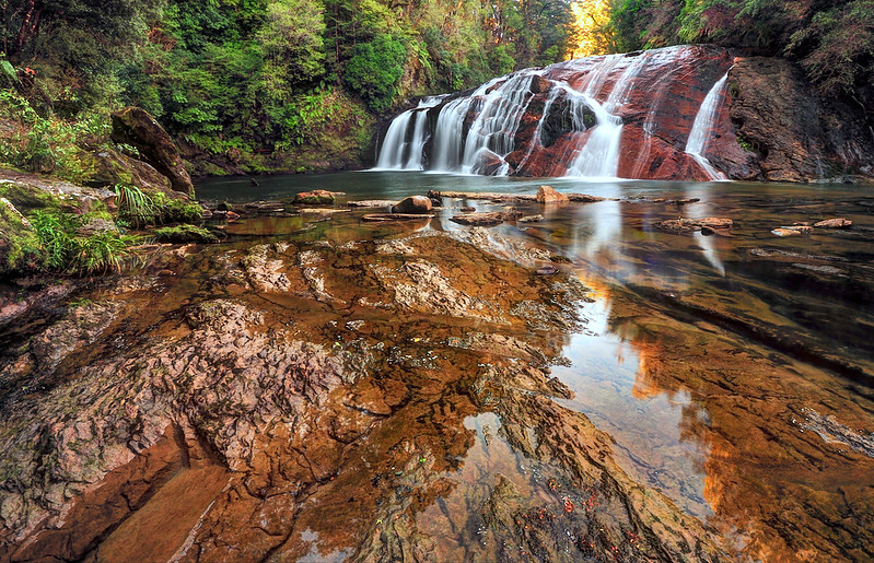
During summer, many people came here for swimming. During winter like this time, the temperature of the water could be around 1-2 degree Celcius.
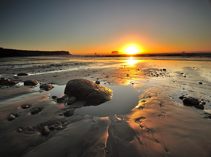
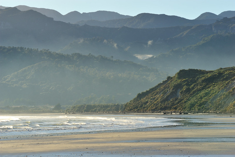
Rapahoe Beach
That evening, I just taking a stroll alongside the beach outside my cabin. Weather that evening was good and I did capture few shots of the sunset.
Sunday 8th July 2012
I have no proper plan for this day so I just went around to walk alongside the beach again. Only during afternoon, I will be walking to Point Elizabeth (4km from my cabin).
Instead of using ultra wide angle lens, I brought my telephoto lens to shoot landscape that morning.
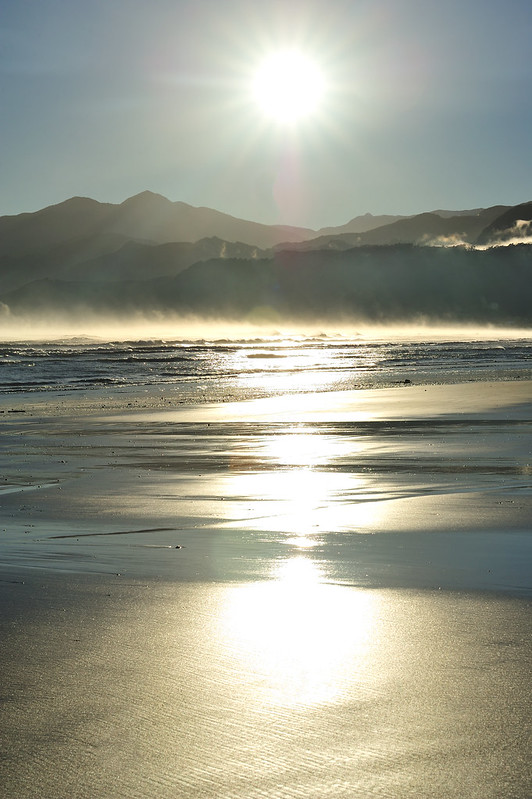
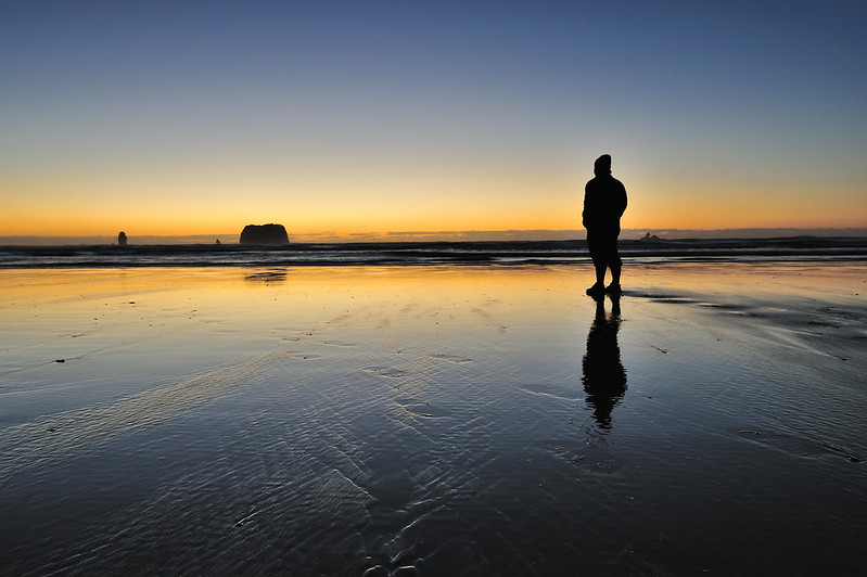
Point Elizabeth.
Point Elizabeth is the end tip of Rapahoe Range nearby. Its elevation is about 100m and one of the best place to see sunset and sunrise alongside the Coast Road. Even Motukikie Rocks can be seen clearly from here.
In order to go here, I went through a walking track with the distance of 4km (8km return) through the thick forest of Rapahoe Range Scenic Reserve. Nikau palm (a unique plant species) can be abundantly found here. After about an hour walking, finally I reached the Elizabeth Point.
There is a bench and table where people can sit there after the tiring walk. Here, I met a Dutch guy who was travelling as well around West Coast. We exchanged our travelling stories and thoughts on photography as well. Great stuff indeed. I stayed there until sunset to take this picture. The view was so fantastic that I decided to recite Azan (call of prayer) loudly there (no one gonna heard me though)
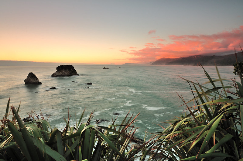
View of the coast from Elizabeth Point.
The journey back was little bit creepy, as there were no people around and it was getting dark. I brought my torchlight to assist me walking in the darkness of the Rapahoe Range jungle. Sometimes I can heard something moving in the bushes, and it was real scary though. I keep walking fast but calm, also need to mind few deep pits beside the track. Finally when I see the road lights from houses at Rapahoe, I feel relieved since I already arrived back.
Will be continued in Part 2.
No comments:
Post a Comment